Method
To reach the objectives of PAStECA, the project is subdivided into 9 work packages (WPs). The responsibility for each package is assigned to 1 or more partners (RMCA, KUL, or ULB).
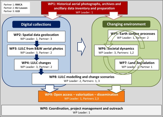
There are three transversal WPs: WP 1 provides the basic data that are the cornerstone of the project, WP 8 will integrate, through different modelling approaches, the outputs from the other WPs, and WP9 concerns the dissemination on the web of the georeferenced historical data and the produced maps in order to share data with the scientific community at large and also raise awareness of the importance of land use change to the general public, policymakers and land managers.
The other WPs are organized into two related groups, the first focusing on the production of a georeferenced digital collection directly from the historical data available at MRAC and the production of derived digital LULC products. The second group concerns the analysis of the changing environment. It involves several WPs that are strongly interconnected. The project goes across disciplines such as population science, geography, geomorphology, geomatics and remote sensing. WP 0 is transversal and deals with the management and valorization strategies.